I have a scale experiment for a game world / terrain tiles
(i removed the zip, since just use google earth at the closer settings you can see pics like this)
This is a project I am working on for a EAW mod - but you can use the information yourself.
The pics for the project not complete - this is just a partial of what I am doing for the mod, I have to map the whole area and make tiles yet.
(edited)
Thanks!
Roy
my scale experiment
-
RAF_Roy
- Flight Sergeant

- Posts: 1024
- Joined: Sat May 01, 2004 9:01 pm
- Location: So. California , USA
- Contact:
my scale experiment
Last edited by RAF_Roy on Mon Sep 29, 2008 5:43 am, edited 1 time in total.

I only ask no one steal my thunder and make tiles for EAW from these.
uhmm,dude,just so were clear on this,I have been capturing satellite data and transforming the pics into EAW tiles for a while now....including Hawaii(for an HR Pearl Harbor) and Japan(for my what if 46 mod).....so,your thunder wont be touched from my end,but realize I already have HR Japan and Hawaii terrains in the works...!


"Ask not what you can do for your country,ask,what has your country been doing to you!"
Thanks for the information  .
.
I will look and see what can be used here.
The game library we are currently playing with is called "DarkGDK"
It is a free library that couples into the free version of VC++ 2008.
The way a terrain is made in this engine is very simple.
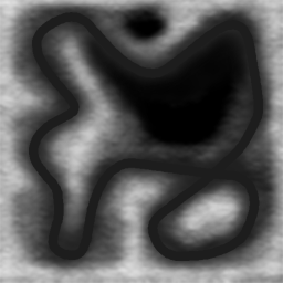
A picture of the terrain height is created where white is the highest level and black is the lowest level.
You basically just draw up the altitude of the terrain or download an altitude hight map from some part of the world.
Here is a typical image of such a hight picture.
The game library automatically makes the terrain from that hight picture.
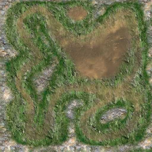
We then overlay the terrain mesh with a corse texture. In this case we use the following picture to do that.
Then we place a fine detail texture over all of that. We could even use a Google earth picture over the top over a real world terrain height profile.
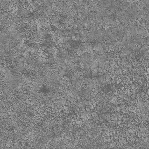
Here is the fine detail picture.
And that is all
The final result is a terrain that looks like this from within the game.
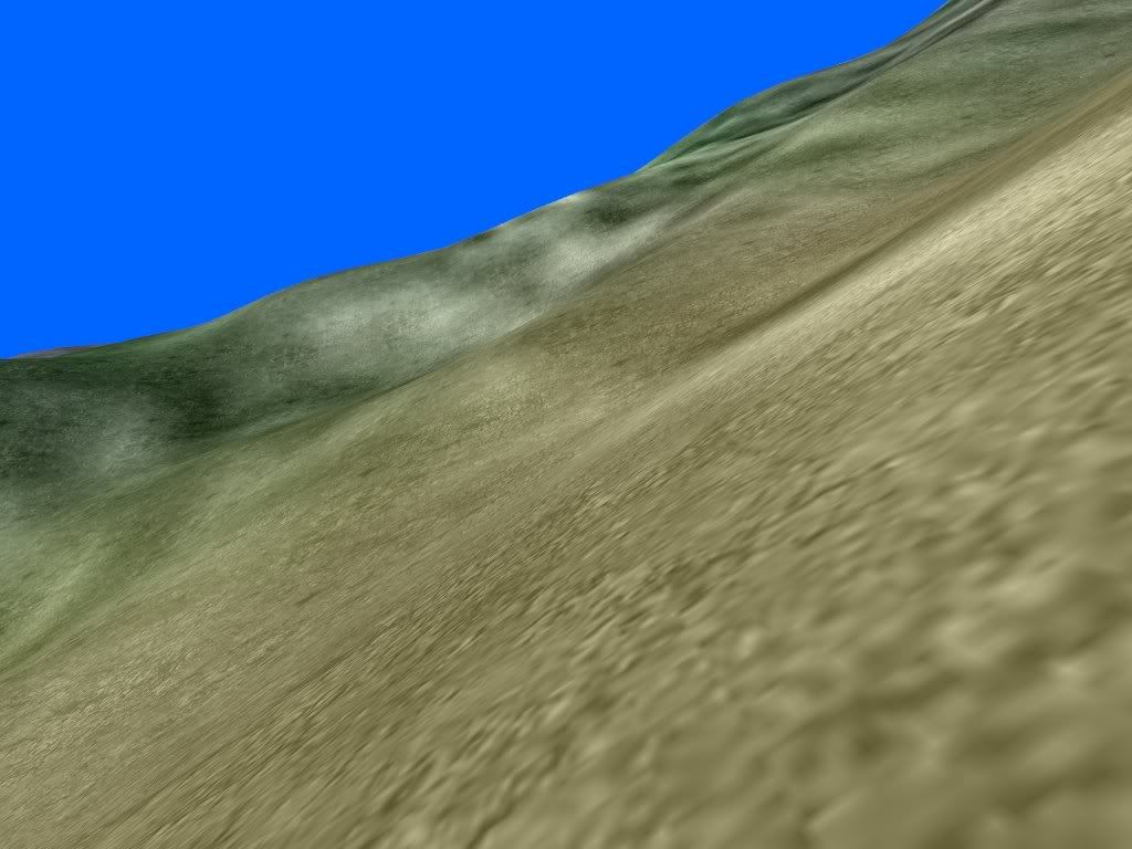
It is so easy to knock up a new terrain in an hour or two, and easier still when using Google earth to get the terrain texture for a certain area.
I will look and see what can be used here.
The game library we are currently playing with is called "DarkGDK"
It is a free library that couples into the free version of VC++ 2008.
The way a terrain is made in this engine is very simple.
A picture of the terrain height is created where white is the highest level and black is the lowest level.
You basically just draw up the altitude of the terrain or download an altitude hight map from some part of the world.
Here is a typical image of such a hight picture.
The game library automatically makes the terrain from that hight picture.
We then overlay the terrain mesh with a corse texture. In this case we use the following picture to do that.
Then we place a fine detail texture over all of that. We could even use a Google earth picture over the top over a real world terrain height profile.
Here is the fine detail picture.
And that is all
The final result is a terrain that looks like this from within the game.
It is so easy to knock up a new terrain in an hour or two, and easier still when using Google earth to get the terrain texture for a certain area.
Syddy........Just another breed of COOL CAT